14 Nov 2018

The Kentmere Round - 1st November 2018

The Kentmere Horseshoe is a well-known and well-documented round, but one I had previously overlooked (again these aren't the very highest mountains in The Lakes and as such, I had assumed they wouldn't be any fun). Again I found that I had left this fine bunch of fells too long, this is a classic round with just enough miles and vert to make it a satisfying day out.

On arrival at Kentmere I was glad to be there early, as there are minimal parking opportunities, literally space for about 7 cars at the village hall when not in use. I hoped it wasn't going to be used later in the day and contributed the suggested donation (or the best part of it based on what I had available)

I took the less obvious path up to the gap on the right, on the Nuttalls' recommendation

looking back

Yoke ahead

the path merges with a good track up Yoke. The clouds were slowly clearing off to the East.
Windermere

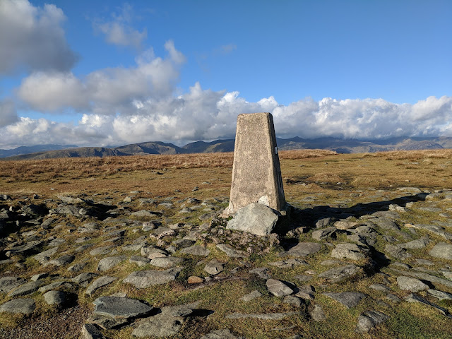
the summit of Yoke

On reflection, the climb up to Yoke really isn't bad, there's enough to sustain interest and apart from the aforementioned short-cut it's not so steep. There are a couple of boggy bits on that route, but the Nuttall's account suggests there are worse boggy bits on the longer route anyway. Nothing to get overly frustrated with. I started near sunrise and it was a damp chilly morning, but the wind was low.  The cloud cover slowly shifted away but I remained in it's shadow for a good while.  It was just about OK in the fleece and windshell, but had to keep moving. Winter's certainly on the way.

peering over the gate to Ill Bell, my next objective

there are a good number of old fence posts kicking about

Magnificent Cairns compete for the highest point on Ill Bell

Once the sun cleared the clouds I was most pleased. I feel like every walk for the last 3 months has been drab and overcast. Given the temperature, it was nice to garner a little heat from the sun.

Looking South

I think this is Froswick summit cairn. Looking North to the next objective, Thornthwaite Crag


Herdwick being adorable as always

Looking back along the ridge, Froswick with Ill Bell looming behind

This post marks the turn for High Street. I chose to visit Thornthwaite Crag also.


The cairn is mental. And a bit rude looking!

The stupendously large cairn on Thornthwaite Crag posed a bit of an issue for me as I like to touch the very top point of each cairn in order to successfully bag a peak. Standing on the 'balls shaped' bit to the right, I managed to reach up and pretty much touch the top with one of my walking poles. I decided this would have to do.

Shortly after I encountered the first other human life of the day in the form of a sighting of a couple behind me (who remained behind me for the rest of the round) and a fell runner coming back from High Street.  It was magnificent to visit High Street on a clear day but the tops of some of the Eastern Fells were obscured by cloud and Cross Fell and friends even more-so.

High Street summit (Racecourse Hill)

Racecourse Hill has some fantastic history, a Roman road, festivals, and horse races

I stopped for well earned sandwiches, using the wall to shelter from the breeze on High Street. I heard voices passing on the path just below and I thought it sacrilidge to come within metres of a summit and not tag the damn thing, not least as this is the tallest of the Far Eastern Fells.

The threesome of Yoke, Ill Bell and Froswick on the left there


looking ahead along the ridgeline to my next objective, Harter Fell. Mardale Ill Bell is in the foreground, it's not got the prominence to be a Nuttall but it looks ideal for a wild camp.

Kentmere Reservoir

The crossroads at Nan Bield Pass. It's important to look both ways for oncoming traffic.

Looking back from whence I had come

Clouds looming in the West


The cairn on Harter Fell is sadly deflated in comparison to when the Nuttalls sketched it. It's still interesting though.


It's a steady and fairly flat grassy stroll over to the last summit of the day: Kentmere Pike

On the way down now, looking back up at an inordinately tall stile

Looking across the valley

It was gorgeous in the valley and the temperature was delightfully mild compared to the tops


The route down from Kentmere Pike to Hallow Bank is a bit eroded and slow going in places but not bad.  I took off a layer as I arrived in the warmer climes of the valley, and found it to be a delightful place. It wasn't much further back to the car which is good because the first smattering of rain of the day came in. A rainbow heralded the removal of my boots.

12 Nov 2018

Halloween Weekend on The Glyderau and Carneddau, Ogwen Valley - 27-28 October 2018

My second weekend of celebration of the coming of the new season was a more solitary affair than the first.  I spent a couple of nights camping in Idwal Cottage Hostel's lovely woods, hiking in the Glyderau and Carneddau with an evening visit to Conwy Feast.
I arrived in the dark on Friday evening having been held up by hefty traffic, and checked in and pitched up in the dark and rain. It does seem to have a fair habit of raining on and off at Pont Pen-y-benglog, nevertheless, I enjoyed a restful evening with the wind in the trees and the waterfalls in the distance.
I awoke to find what I had hoped for based on the forecast; a light dusting of snow on the tops. How befitting for Halloween and the welcoming in of the new season. I set off into Cwm Idwal and decided I might have a crack at Senior's Gully and Ridge. At least the top part of Senior's Gully.

looking across Llyn Idwal to Y Garn


I missed my turning for the path I knew that leads up to the upper portion of Senior's Gully.  I chatted to a couple of fellas who had camped in the cwm and were prospecting on heading up the Cneifion Arete.   They mentioned that there is a path at the very bottom of the gully, so I headed for this and up into ground which I don't know. It was cold and the rock was all damp and greasy in places. I was unsure of my exact route and decided to trailblaze up to where hopefully the path I do know is.  A heaving going pathless traipse up steep ground ensued. Finally, much higher up than I thought, I caught up with the path I wanted to be on in the first place, which leads to the upper portion of the gully and ground that I knew well enough to approach with confidence even in the cold conditions.

The rocks were so cold I had to stop and put gloves on before I exited the gully, but it was in workable condition and despite Ashton's '1-' grading there's enough to provide a bit of excitement not least when everything is a bit damp.

Llyn Idwal

Pen Yr Ole Wen chilling on the right there...

A rather beautiful Cwm Cneifion

some icicles already!

Y Gribin with Tryfan in the distance there

I enjoyed making my way up Senior's Ridge. I think it's a bit of an unsung route, nothing stressful but some interesting bits and bobs if you look for them but if I'm honest given the conditions I stuck to the more obvious path and lines for some of it.  I did get a bit off-piste and had to retreat on a couple of occasions near the top where there are some very large rocky bits with limited holds.

Interesting rock formation at the head of Cwm Cneifion

Glyder Fawr, the top of the Glyderau and just over 1000m

looking over to Y Garn, my next objective

The Snowdon Range

Llyn y Cwn

looking back to Glyder Fawr whilst on the way up Y Garn

Pen Yr Ole Wen from Y Garn

There were a few other people heading up Y Garn, typically I decided I had to go at 1.5x my usual pace so as not to look fat and slow, and I was fair panting by the top of the steady climb.  Y Garn is an exceptionally popular mountain and there were a fair number at the top. This was my second visit to the summit and the first whilst not in cloud. Given the opportunity to witness the views I understood why it is such a popular peak.
In the back of my mind, I had considered heading out further along the ridge to cap Carnedd y Filiast or Elidir Fawr, but it looked far and the wind was ridiculous. For another day then.

Cwm Clyd

I made my way down the Idwal Cottage and had a little chill in the lounge in the hostel before heading over to the festival at Conwy where there was a lovely atmosphere. It's a nice part of the world by all accounts.

I awoke early the next day to pack up the tent and was underway around dawn. Today's objective was the traditional Southern Ridge circuit of the Carneddau but with the direct ascent up Pen-yr-ole-Wen from Pont Pen-y-Benglog.
I have never hit this climb before and I really enjoyed it. It's steep from the off with a few scrambly bits here and there, enough to make it interesting. There are some sections of steep scree, so I guess it might not be everyone's cup of tea.  I fancy trying this route in descent at some point.

Looking back towards the hostel

Cwm Idwal with Snowdon peaking over the col

Foel Goch with Y Garn on the left and Elidir Fawr on the right there

Looking North-West across Nant Ffrancon to Ynys Mon

Cwm Lloer

Looking back toward Pen-yr-ole-Wen

The wind was harsh and I layered up near reaching the summit of Pen-yr-ole-Wen. At Carnedd Dafydd summit I met a nice fellow who turned out to be an outdoors instructor who was training for his Mountain Leader qualification. Ian if you're reading I hope your assessment has gone well for you. Ian joined me on the way over to Carnedd Llewelyn and on to Bwlch Eryl Farchog, and it was interesting to discuss in depth the ins and outs of the Mountain Leader qualification amongst other things for the most part mountain related.

It felt very wintery on Carnedd Llewelyn summit

Sadly there were no views to be had from the top of the Carneddau on this day. We headed down towards Bwlch Eryl Farchog, a magnificent ridge with brilliant views and features, the path is punctuated by some straightforward scrambling.  My new acquaintance headed back down as he had a lengthy drive ahead, whilst I pressed on for Pen-yr-Helgi-Du.

awesome crags on the North-East side of the ridge with Cwm Eigiau beyond


Looking along the ridge to my next objective, Pen-yr-Helgi-Du

Ffynnon Llugwy with the Eastern Glyderau beyond

Cwm Llugwy

Looking back toward the awesome features on the ridge


Wild Ponies on the slopes near Pen-yr-Helgi-Du summit

Carnedd Llewelyn summit still having a cloud issue...

The route down

A delightfully easy-going grassy ramp winds things back down to valley level from Pen-yr-Helgi-Du.  It made a nice contrast to the steeper bits from the previous day's efforts in the Glyderau.

Gallt yr Ogof

The path crosses a leat, which feeds water around into Llyn Colwyd Reservoir

The magnificent Tryfan

a proper old-school bridge


On arrival in the valley a lengthy but flat walk back to Pont-pen-y-Benglog along the route of the old A5 awaited me. I never realised how lovely the valley is, I've blasted through in the car on many occasions but never realised how delightful a place it was.
All in all a magnificent weekend!