24 Oct 2018

Summit Camp in The Northwestern Fells - 5th and 6th October 2018

This is one of those when I was determined on getting a wild camp and it had to be a summit camp at that...
I had been scouring the rather hit-and-miss weather forecasts all week and it seemed like my best bet would be on the North Western Fells. I warmed to the idea as I had never visited this area. I had always assumed it would be a bit of a dull place 'as the fells simply aren't quite as high as some of the others'... What nonsense, this is a fantastic place, to say the least.
I parked up in Braithwaite, as extensive road repair work rendered the 'Grisedale Pike car park' out of reach, kitted up and struck my way upwards towards Barrow Door. 

looking back towards Skiddaw with a little clag

Stile End, with Barrow Door on the left and Causey Pike looming up just 
behind
Causey Pike

Sweeping around to join the track running parallel to Stonycroft Gill up toward High Moss

I decided to skip Causey Pike and Scar Crags as I hadn't been out with the full overnight pack and three season bag for a while and didn't want to overdo it, also the direct grassy ascent looked a bit steep and tough going. There is actually a better path that contours around further up the valley which would be a preferable route, and in retrospect, for the little additional effort to include these two peaks I regretted not visiting them, but they are there for another day.

Looking across Coledale to Grisedale Pike

looking South-East

On reaching the col and turning right to head up Sail the views start to really open up, as did the drizzle.  I donned the windproof.

A rather tourist-friendly zig-zag path has been built on the way up Sail, you can still see the extent of the damage the old 'path' has caused so I do understand the rationale, but I couldn't help feeling like a veritable motorway had been built up here.

looking along Sail Beck towards the Buttermere Fells

Crag Hill (aka Eel Crag) has some magnificent features and is the second tallest of the North Western Fells

I wondered whether Sail was named so because it resembled a sail from a certain angle. The etymology is a touch less romantic, it just means swampy hill...
Probably one of the most exciting sections of the route follows, The Scar is a neat interconnecting ridge and has a couple of 'quasi-technical' bits, nothing serious mind.

Grisedale Pike

looking back along The Scar with The Helvellyn Range in the distance

looking over Knott Rigg to Robinson, with Hindscarth on the left and The Southern and Western Fells on the horizon

Looking back again to Sail

Crag Hill Summit
After topping off Crag Hill and stopping for a well-earned sandwich, I spotted Wandope and figured out from the height and prominence on the map that it would qualify as a Nuttall, and an easily reached one at that! I decided I had plenty of time and energy so I popped over for an unplanned visit.  I'm glad I did as I was rewarded with magnificent views of Scar Crags, on the Southern face of Crag Hill. 

Scar Crags

Looking East

Wandope Summit

After bagging Wandope Summit I headed towards the stream a little below the col between Crag Hill and Grasmoor. The objective was to find a source of water, I didn't have to go far at all to find a suitable source to filter and fill up my bottles for the overnight on Grasmoor. I had just about decided to go for it with a summit camp but I had time and light to get back down to Coledale Hause if a suitable spot could not be found up top.

Looking back toward the col, Crag Hill on the left and Wandope on the right

A brief uphill pull and a dander along the plateau were all that remained of the day's exertions now.

Crummock Water

Whiteside and Gasgale Crags

Home for the night

A rare selfie

It was a bit Baltic on the top, as near to zero as it gets without freezing and with a steady breeze. I found a spot where the wind was a touch less intense but there was a steady breeze going through the tent. At least condensation would not be an issue.  The tent was a bit noisy in the wind but it wasn't enough to make it feel unsafe. The forecast showed it wasn't forecast to pick up with any significance until the following morning, by which time I would be gone. Having pitched and enjoyed a nice coffee I took an evening stroll around Grasmoor summit. I hadn't seen another soul (bar the occasional sheep) since Crag Hill, and I wouldn't until I was nearly back at Braithwaite the next morning. I was a little suprised as I had expected Grasmoor to be a super-popular fell, heaving with tourists, but on this Friday late-afternoon it wasn't the case.

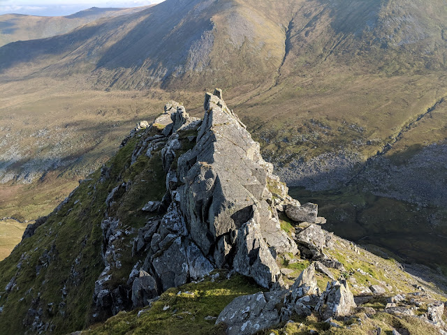
There are some excellent pinnacles on the North side


It was one of those moody ones. I kept strolling around with a view to taking in the sunset but there was just all this moody stuff. I did enjoy it though.


The views were splendid from Grasmoor, I could see right over to the Isle of Man and across to Scotland. As night drew in I retired back to the tent for a lovely Summit to Eat supper (apt?) which was just the ticket. Really it was cool up there, I wished I had taken my bigger hat and maybe even a more substantial down jacket. I would have been better-off wearing long-johns too!

Grasmoor summit shelter

Loweswater

On popping back out later on after having eaten I revisited the summit and enjoyed the light show, photos don't do it any justice mind.


I slept OK by all accounts. I turned in once it was fully dark, by about 8, and didn't get off to sleep until 10. For a while at first it felt like I was losing heat through my insulated air-mat, but this seemed to stabilise after a while, maybe the mat itself had gotten cold and needed 'warming up', I don't know, but at about 10 I drifted off and didn't awake until 2am, after which I was in and out of sleep. I set my alarm at a ridiculously early hour when it was still dark, I awoke and prepared breakfast in the dark and I was packing up the tent just at the point there was enough light to start moving. Perfect timing.

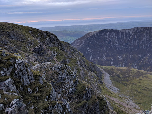
Blue hour in the morning

The morning was clear despite there being no decent sunrise. You can just about make out Cross Fell here

I decided that Grisedale Pike felt like overkill with the extra weight, and headed directly back to Coledale Hause and along Coledale.

Coledale from Coledale Hause

a ford

Force Crag is super-interesting. the camera doesn't do justice to the detail

Looking back up to Force Crag with the disused mine workings on the right

The stepping stones across Coledale Beck were nearly engulfed

looking back up towards Crag Hill / Eel Crag

Braithwaite and the scariest part of all; 'the return to civilisaion'
Extensive road works


After taking in the scale of the operation to apparently stop the road from falling any more into the beck, I trundled back to the car and went for a pootle around Keswick. Typically the sun came right out as I started the drive home and the colours in the woods along Thirlmere were beautiful. I guess the preceding weather had been more pleasant for hiking in all the same.

17 Oct 2018

Carneddau Round from Gerlan - 29th September 2018

My first time back in glorious Snowdonia after my ankle incident, and it was wonderful to be back, and wonderful also to be paying a long, long overdue the Carneddau. I last summited Carneddau Llewelyn and Dafydd when I was 17, on a school weekend trip almost half my lifetime ago. It was then that I first fell in love with the Ogwen Valley and all the wonders surrounding it.
This time I had a slightly different objective, I was starting from Gerlan (above Bethesda), the goals were Carnedd Dafydd, Carnedd Llewelyn, Foel Grach and whatever else I felt suited on the way back.

a choice of stiles

OK, so things got off to a dodgy start. I decided I knew better than to bother reading the guidebook and that the more direct path towards Cwm Pen-Llafar was on the left of the river (it's actually on the right). I was skirting around a farmyard with a hoard of dogs going completely mental within moments, then I briskly made my way up on a more-or-less trackless route through fields and reeds. I got a bit lost around some ruins, I crossed the rather broken stile on the right of the photo above and had to precariously cross a barbed wire fence, trying to avoid damaging my new pants.  I thought crossing the river to join the path would be straightforward but it simply wasn't. I saw the good path up the Mynydd Du, and despite best efforts, I was unable to cross to reach it.
I decided at this point I would try the Crib Lem / Llech Du scramble after all. My first proper scramble for a good while as it goes... So I progressed on the non-path side of the river through reeds, bogs, etc up the Cwm before eventually finding a suitable crossing point. We live and learn.

not 'the' infinity pool, but maybe it's 'an' infinity pool?

the sun hitting the slopes above

The going was much easier once I got on the good path on the right / West side of Cwl Pen-Llafar.  It's a veritable motorway for the hillwalker by all accounts.

looking across the cwm toward Yr Elen

I found the walk up through Cwm Pen-Llafar completely gorgeous. It's so unspoilt and prime for wild-camping. I'll be back without a doubt. It's also really remote, and the sense of disconnection from the bustling world made the prospect of the forthcoming scramble feel all the more serious, even if it is rated at grade 1.
I had photographs of the pages of Steve Ashton's book for this scramble in my phone, on studying these I came to understand that the approach route could have been a lot easier. I also figured out where I needed to go next. I'd recommend always taking a guide for these sorts of things, and using it from the off!

The guide advises one to 'avoid the temptation' of going headlong up these cliffs. I wasn't so tempted anyway as it goes. The route goes up to the right and appears fairly well trodden.

Cwmglas Bach

Foel Meirch - a Nuttall by all accounts and thus on the to-do list for another day

a grassy ramp leads up to the start of the scrambling proper

Carnedd Llewelyn

some high-level sheep to be spotted

as I surmounted the shoulder of Crib Lem I heard a lot of noise behind me. The farmers and their sheepdogs were rounding up the sheep. Given the positioning of the sheep, it appeared they had quite the day ahead of them!

Looking up the Crib Lem ridge. Awesome stuff in the most awesome of surroundings

Yr Elen looking all the more impressive from this position

I'm referring to this as 'the famous bit' on the Crim Lem route. I used the ledge to the right on this photo. When I go back I'll definitely be up on the slab though.


Tryfan and Pen yr Ole Wen from Carnedd Dafydd summit

in a bit of a cloud sadly

Cefn Ysgolion Duon

Carnedd Llewelyn summit. The cairn is actually the summit. I spent a wee while figuring this out as the rocks on the left can't be much lower. This is indeed the very top of the Carneddau and the third highest point in England and Wales.  The picture doesn't show it but the wind was full-on up here.

looking back to Carnedd Dafydd from whence I had come

The path from Carnedd Dafydd to Foel Grach is not entirely obvious, I took a bearing and over grass and a few rocky bits before finding it all come together as more of a trod.  It's a steady cross-country walk vibe between the peaks of the Carneddau, and if it were not for the 'top of the world' style views you might as well be anywhere. Easy going walking in the most part, but the atmosphere is incredible and, despite the presence of a few fellow hillwalkers here or there, these are some of the most remote locations available in England and Wales and the extra distance between here and 'civilisation' makes the prospect of rolling an ankle, or worse, feel all the more sinister.  Unlike Snowdon, this mountain is not abandoned to the tourist. There are no railways, pipelines, nor ill-equipped chavs.

approaching Foel Grach summit

Foel Grach summit rocks

the emergency shelter

The emergency shelter at Foel Grach provided enough cover from the wind to be able to enjoy a wee sandwich.  Here I met a fella and two lasses who turned out to all be on a double-date (he was under a lot of pressure as he had to make a pick when he returned to sea-level), and a couple of brave MTB dudes. I don't take umbridge to meeting cyclists on terrain like this - granted they were illegal and not on a bridleway, but bicycle tyres don't do any more harm than footprints in the majority of instances, and anyway, there is more than enough space for everyone on the Carneddau. The local wild ponies likely churn the ground up more, and they are also not on a bridleway. I'm a fell-walker but I was once an MTB dude myself, and I want us all to get on better than we apparently do sometimes.
Whilst consuming my sandwich I observed that Carnedd Uchaf (or Gwenllian if one feels inclined) was much in a cloud. I decided to skip this summit and to take the trod on it's western slopes.  I was tired and not in the mood for navigating pathless in fog, and decided a direct return was wiser than trying to include Bara Bach and Drosgyl this time, bearing in mind also that I had taken on the more arduous scrambling option of Crib Lem earlier in the day.
This trod is faint but relatively easy to follow and is rather fantastically marked with stones which have been remarkably wedged and balanced to fashion vertical waypoints. I wound up off-course at one point but only by say 40 metres.

Yr Elen looks splendid - I'll be back to bag this one!

a wild pony - they really aren't shy

Toward Cwm Caseg from Gyrn Wigau

the zip-world quarry in the distance

A steep descent through slopes that I can best describe as 'sheep central' took me to a track. On reaching the pumping station I ran into the day's final obstacle in the form of a sheep-herding operation in the track that I wanted to use to get back directly to the layby in which I had parked.
I wasn't even sure if said track was a right-of-way (it's one of those lanes in white on an OS map...). I decided to leave the farmers in peace to crack on with what I reckon is fairly tough work, and I reverted back up the hill to meet a definite right of way, a swift ten-minute detour brought me back to the car.


To conclude I thoroughly enjoyed my day out on the Carneddau, the vibe is different to the Glyderau and Snowdon range, it's all that bit more remote. These mountains aren't without interest either, there are beautiful cwms and crags, and as for scrambling the Crib Lem scramble was fantastic, underrated to say the least. As for the potential wild-camping opportunities, it's somthing else! I'll certainly be back here in the spring for a summit camp or several.