Stardate 11-March-2018.
I emerged from the car a quarter hour before sunrise, to the mellowest meteorological conditions we have felt in a long time. As I kitted up and set off through the village of Patterdale, drinking in the still air and clear views, I felt child-like excitement at being in a place I love so dearly. It was six am on a Sunday and not a soul seemed to stir.
As I turned up Grisedale and towards my first objective, I was relieved to see some snow remaining at least on high ground, I had been apprehensive that all the winter fun would be long gone following a warm spell and a massive thaw, gladly snow and ice takes longer than a day or two to dissipate.
Beginning the ascent amongst t'sheep
This was my first time coming up on the Grisedale side having only ascended from the East via Miresbeck from Glenridding in the past. I had become strangely attached to the Mires Beck route and didn't think it could get any better, but I found the path up from the valley side from Patterdale offers a delightfully easy gradient and magnificent views throughout, a new favourite perhaps?
St Sunday Crag loomed on the left. As I ascended I tried to sight the location of Pinnacle Ridge, but it was hard to pick any sort of detail out whilst the North facing slopes were in shade...
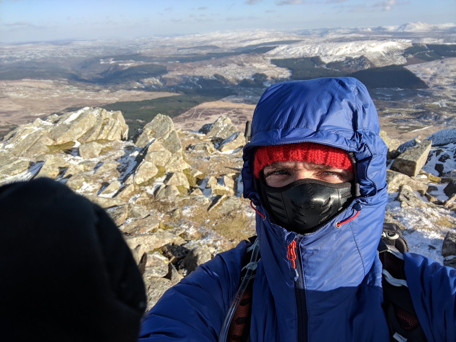
As I encroached towards Hole in't Wall there were several patches of rock hard snow/ice which required care and an ice axe to be passed safely. On reaching Hole in't Wall I found an icy slope with a flat runoff that was ideal for practicing some step cutting and self-arrests so I duly proceeded. Having received a face-full of ice I proceeded on towards Striding Edge. I'll never tire of that magnificent moment when the East face of Helvellyn and Red tarn come into view.
Red Tarn: Frozen but not safe to walk upon...
In the past I have stayed on the lower path towards High Spying How from Hole in't Wall, but this time I kept to the ridge and was stunned by the views! It was clear this early and looking back I could see Cross Fell on the horizon. One day I shall conquer this too...
looking back towards Place Fell and the East.
The crampons had been donned for the icy slopes leading up to High Spying How before Striding Edge came into view, once I reached it there was less snow on the edge itself. I kept them on, although they were only really put to use on the occasional patches of ice. Looking back an ice axe may have been suitable for this but I felt more secure having easy traction on the icy bits and especially the steep bank of hard snow which guarded the end of the ridge. On topping out the slope I felt a little leap of joy knowing all the difficulties were overcome, off came the crampons and I strolled up to the summit for second breakfast... It was now 10 am, four hours after setting off.
I had the summit all to myself...
Fantastic views prevailed, with some cloud inversion to the South and East adding to the beauty of it all...
Looking South-West
I then proceeded South along the Helvellyn massif, instead of the main trunk route I took in the summits of Nethermost Pike, High Crag and Dollywagon Pike (or Dolly-Mixture Pike if like me you cant take life seriously)... After four hours without seeing another soul it was pleasant to see and speak to a variety of fellow travellers who were emerging onto the high fells as the morning progressed.
The plateau of Nethermost Pike with High Crag and Dollywaggon Pike centre and left respectively.
Cornices were lurking along the whole range.
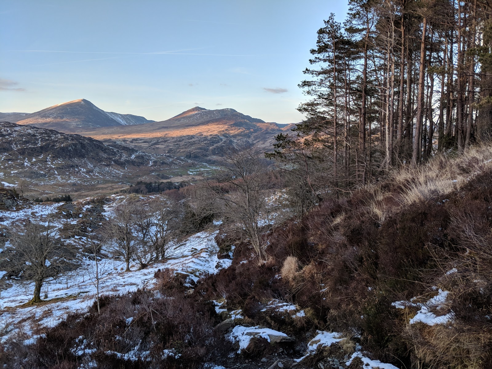
I have another brief refreshment stop on the summit of Dollywagon Pike, where I contemplated and relished the prospect of one day ascending via The Tongue, before descending to Grisdale Tarn down the 'Charabanc Route'. As the day progressed all but the most sheltered snow was becoming soft and slushy. On the way down I looked across at Fairfield and considered my options on how to ascend. There were three - really two as one is a path I swear I once saw going directly up the steep north side and want to try but I have struggled to find any guidance on it! I couldn't even see this route today, plus given the prevalence of snow and relative steepness, I left this 'great unknown' to the Summer. Either I would ascend the straightforward West corner or take a more interesting line up to Deepdale Hause and on up the East ridge via Cofa Pike. Whilst I had no experience of the route and it looked a touch menacing, I chose the latter, considering the former to be a cop-out.

Grisedale Tarn was partially frozen, but not safe to walk upon.
I had a choice of paths up to Deepdale Hause and on a ridiculous whim chose the higher and less established line. Sure enough in the shadows there were deadly steep banks of rock hard snow to traverse. The action of freeze-thaw meant old footprints offered little traction and it was impossible to kick into. On one of the particularly treacherous and unavoidable ones I tried to proceed but with the steepness and my inexperience with an ice axe I decided it best to turn back and try again once shod with crampons. The lower and better-trodden path avoids crossing at such a steep angle, but I do suppose I like a challenge.
I kept the crampons on right to the top of Fairfield but needn't have, once at Deepdale Hause and out of the shade the snow was soft and manageable.
Grisedale Tarn and Central and Western Fells from Deepdale Hause
looking back toward Helvellyn
On topping off Fairfield I removed the crampons and had a break at the cross shelter after a nice natter with a couple of local fellas. I was grateful for some views as I had only been here in cloud previously.
Pedestrian traffic flowing steadily on the Fairfield Horseshoe as overcast skies move in overhead
I joined the throngs, moving clockwise around the Fairfield Horseshoe as I progressed towards Hart Crag. There were large sections of very soft, saturated snow, which I likened to walking on a 'slush puppy'. Given the thaw and heavy rain the evening prior I pondered the wisdom of the many walkers undertaking the classic circuit from Ambleside, I would sooner do it in dry weather myself given there are some boggy sections I know of, one so boggy it has its own warning signs!
Not to worry though as my route turned off the mainline at Hart Crag heading Eastward descending to Hartsop-above How. Brandishing the ice axe I carefully made my way down some steep sections of soft snow and some scrambly descents. I took the more Northerly line and on reaching the bottom I could see an easier line on the South. I felt a little bad for the people following me directly behind as they picked their way down the steep rocks and ice!
Looking back up to Hart Crag in the centre, Fairfield on the right.
I took a final rest stop on the summit of Hartsop-above How. I adored how the valleys and trees looked like model miniatures directly below, but I was starting to really feel fatigued now. I reached the end of my water supply and geared up for the final slog. Hartsop-above How is gorgeous but it has many 'false bases' and the gradual descent really does seem to go on forever. I guess to someone less weary and impatient it would give lovely sustained interest and if coupled with a descent in Dovedale to the South would make a lovely afternoon outing.
tree in the foreground, St Sunday Crag in the background
I felt great relief to finally reach the road. A nearby stream afforded me a chance to rinse some of the mud off my boots. Whilst there's a lovely quiet path on the East side of the valley, I opted to stay on the road as I didn't have the willingness to take on extra mileage. A steady kilometer or so on the flat footpath saw me back to the car. En-route I observed in awe as a shepherd working with 3 dogs to round up sheep on the steep slopes of Arnison and Oxford Crag. At first, I thought maybe he was shouting that I was doing something wrong or had dropped something, then I thought he might have been flying a kestrel...
I reached the car at 5pm, 11 hours after setting out, feeling achy but with a great sense of achievement. A magnificent day!